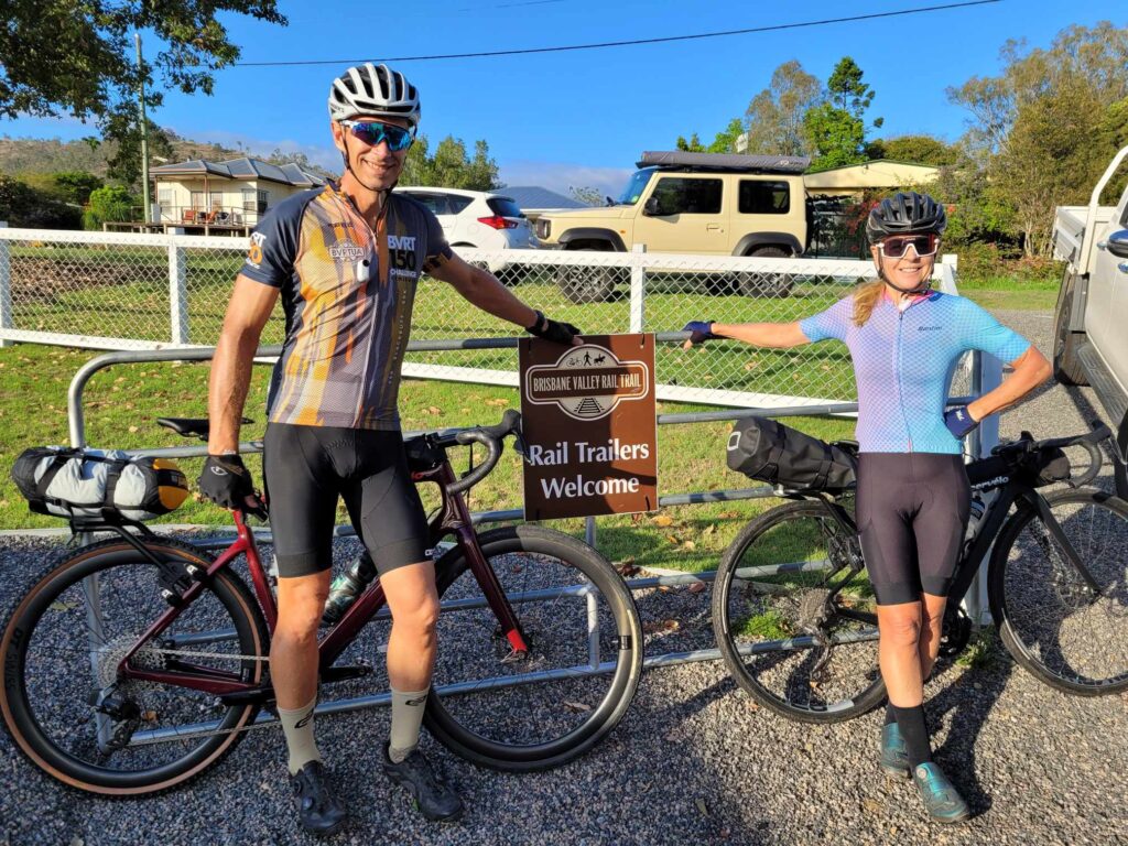
While it is fresh in my head, here is a blog write up of our weekend spent riding gravel based out of Linville on the Brisbane Valley Rail Trail. By way of background, we (boyfriend Daniel and myself) planned the weekend as a test event for a 4 day ‘pseudo bike packing’ trip we have planned on the Tasmanian Trail in January. I say ‘pseudo bike packing’, because one of my friends told me today in no uncertain terms that we definitely were not proper bike packing. Heck, we don’t want to carry a tent and all our cooking gear. We do however plan to ride from point to point along the Tasmanian trail covering 400km and 6600m of elevation in four days. We are planning this as a credit card ride. That is, carrying minimal gear only – a change of cycling kit, street clothes, toiletries and bike tools. The credit card is to pay for anything we need along the way. Accommodation is pre-booked at planned stops, so we HAVE to cover the 100km of mapped route each day to get to our accommodation.
In order to do this, I needed to transform my racing Cervelo Aspero 5 into a bike packing rig. Yes, the very same bike I raced Worlds on 8 weeks ago is going to be used for the Tassie trip. I love my Aspero, so it does seem somewhat incongruous to be adding weight to it – but there you go. I’m going to list my equipment, but as always I point out that I have no commercial arrangements with any of these companies.
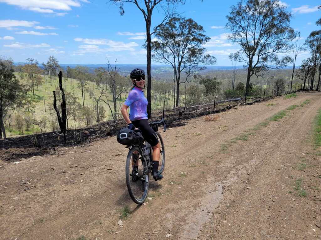
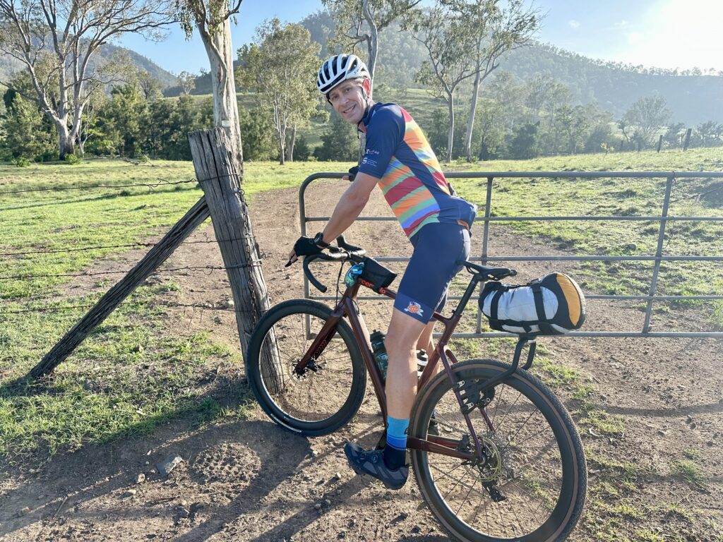
Because I ride a really small frame (48) I am limited what I can put on the bike in terms of frame bags. I opted for this Aeroe Spider rear rack, the reviews were good and it is very flexible. The first pic shows the setup I initially did. You can see the bag is sitting too high. Dan then inverted the rack so the bag sits lower. This was much better as I did not feel the weight behind me as much. I like to stand up out of the saddle on punchy climbs. I’m only 50kg, so I can feel the difference that 3kg on the back makes. I learnt quickly that it is much more comfortable to stay seated, drop into the small chain ring and spin up the inclines in the saddle. That is a 12l Aeroe dry bag on the back. It had about 3kg worth of gear in it and there was room for more. For Tassie I will likely have around 4kg in it.
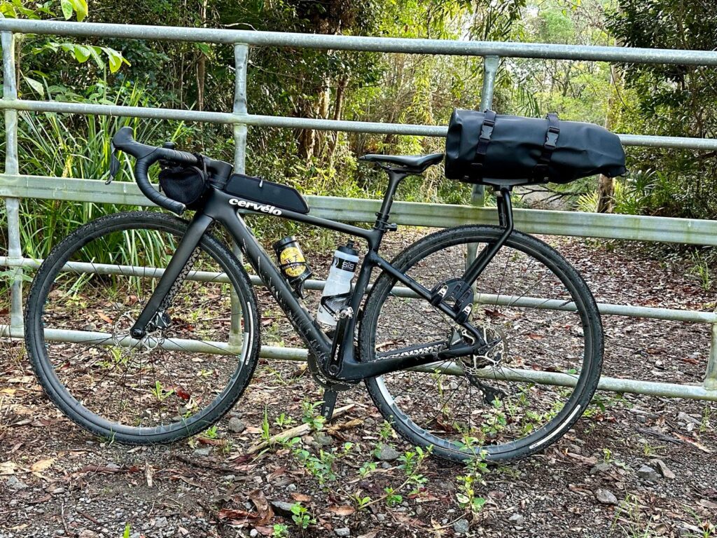

If you needed to carry more, then you could purchase an additional cradle and bag from Aeroe and side mount them on the frame. But I reckon I can carry all I need with just the one so this will suffice for Tassie. Part of the challenge for us is to ride as minimalistically as possible! On the top tube I have the Cervelo bento box. I use this in long races and rides, and it is pretty handy. I have a zip lock bag with my solid food in it, plus there is room for a couple of gels. On the handlebars I have this roll bag from Scicon which has all my tools in, plus phone and other essential items.
The only other thing I am going to change out are the wheels. For this gravel reccie weekend I used my ‘race’ wheels. These are hand built Craftworx and I had tubeless Gravelking Panaracer SKs in 38 as tyres, running 30 PSI. For Tasmania I am going to use the original wheels that came with the Aspero which are Reserve 32mm, with Pirelli Centurato Gravel M in 40mm.
That is it for the equipment; now to where we based ourselves and the route. I knew I wanted to map out back to back 100km rides, as much as possible on trails, and starting and finishing from the same location. I chose Linville and it turned out to be a great choice. I’m always happy to support local and someone who is also in the industry. Chevonne Arrowsmith has done a fab job setting up the Rail Trail Refuge in Linville, which she opened this year. Inspired by her time bike packing, Chevonne wanted to build accommodation that has everything an intrepid bike packer could want, but not more. She nailed it. Comfortable bunk rooms, communal bathroom and kitchen, continental breakfast, coffee, a plunge pool, bike washing facilities and local knowledge. All this for less than $100 a night for a single and $150 for two people. The perfect clear nights and star gazing are an added bonus.
For the routes I used a combination of my own knowledge, a fellow graveleur who has ridden here a lot (thanks Daniel Mendes) and Chevonne’s recommended routes. They turned out to be fantastic choices. I need to emphasise here that there are many routes adjacent to the BVRT that are not actually on the trail. I have heard some riders say they have done the BVRT and don’t need to do it again. Fair enough, but I don’t agree. I love the BVRT and would happily do it over and over (ask a Brisbane based rider how many River Loops they have done). Our two rides were a combination of BVRT, other gravel trails, and some necessary bitumen on back roads – let me take you through them.
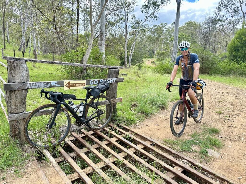
Day 1 – 124km/1700m. At the bottom of this blog is the link to my Strava file so you can download the route. Please correct out the little trail errors we made, these are easy to see if you enlarge the map. This loop is known as the Linville Nanango loop. You start from Linville and head straight onto the BVRT for the ever so slight uphill run to Blackbutt. We had a reasonably early start (just after 6am) as the other people staying at the refuge were also up early, taking a shuttle from Moore to Yarraman to do the run down. We knew we would pass them in the opposite direction somewhere on the trail. We had a couple of early breaks to reconfigure Dan’s rear rack. He ended up inverting it, to get the weight lower. I of course sat on the side of the trail filming the shenanigans and acting as peanut gallery with helpful words of advice (not). The speed difference with the packs on was about 3km/hr which is not too bad. For me, I notice the load mostly in my legs. You are pushing the same power, but it is harder work hauling a heavier bike uphill. Memo to self – hit the gym to strengthen the legs a bit more.
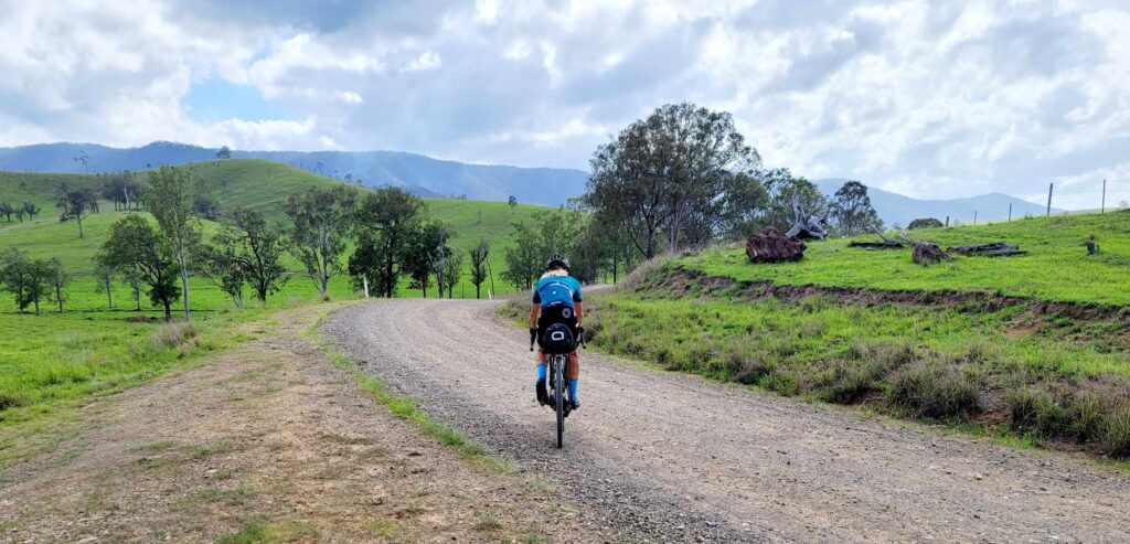
We averaged about 18kph to Blackbutt (20km) and rolled straight on (what no bakery stop, sacrilege). Soon after we saw the smiling faces of the shuttle riders as they descended down into Nukku. We continued on towards Yarraman and to be honest, I had forgotten how nice this section of the trail is. There is a bit more variability in the terrain which mixes it up. We were feeling good at 40km, so there was no need to head into Yarraman as we did not need to top up water. We took a short deviation to get onto Noora Rd then Din Din road. This is known as the Nanango Link trail. It was beautiful ‘champagne’ gravel to start with. Not a car in sight, even though it was perfect road to drive on. After about 10km the trail changes somewhat to a proper ‘trail’. It was a bit rutted, but perfectly rideable on gravel bikes. There was one river crossing which was not rideable – we walked through on the rocks and pushed up a steep rutted exit.
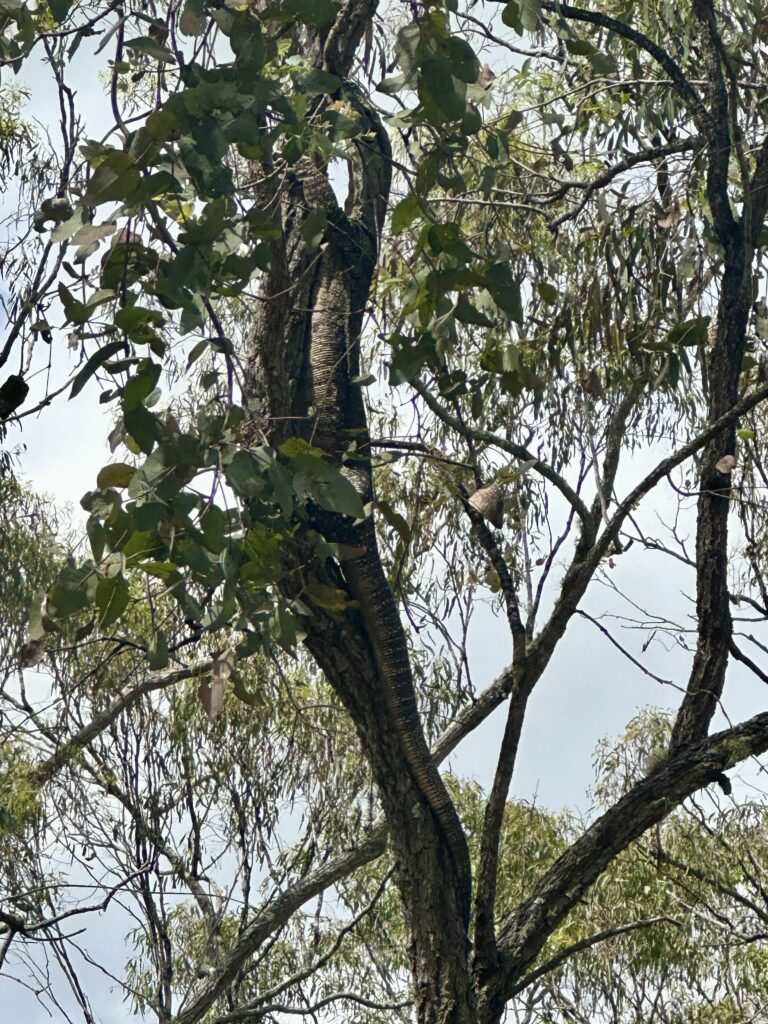
From here the trail winds around, and is again rough but nothing over the top, and lasts in total perhaps 5km. Then it is back to lovely champagne gravel, and this magnificent specimen who was sunning themself (winning with the pronouns) on the road, before our noise sent them tree ward, but I still managed to capture their camouflaged brilliance.
At this point we headed into Nanango and the bakery for lunch. 60kms done and 3.05 hours on the clock, and it was starting to get hot. We had been warned that there were no water stops between Nanango and Linville on this loop (65km to go) so topped up the bottles and headed out. A short section of bitumen before you turn back onto gravel and the Mount Stanley climb. This was pretty special, with amazing views. We were lucky to have good canopy cover with the trees which kept things cool enough (relatively). This photo taken at the high point of the climb. Clearly there had been just enough rain about to keep things green, without muddying the trails.
You exit the trail and have a couple of short sharp climbs on bitumen. How Garmin Climbpro does not rate these as climbs I do not know. We thought we were done with the climbing, but we were not. In any case, we were rewarded with a super fast and fun descent down Mt Stanley towards the Brisbane River. After this descent you have a meandering, predominantly gravel ride crossing the Brisbane River back and forth for about 20km.
At this stage though it was starting to get hot. We had plenty of water, but it was as warm as soup, which is not conducive to drinking it. I have to be honest and say that the final 25km of this ride on bitumen was a slog. You take a right turn back onto bitumen for the run in to Linville. It was close to 40 degrees and we were suffering. The conversation and banter vaporised as we focused on getting the job done. It followed a pattern of – descend, cross Brisbane River, ascend; repeat. It seemed like a lot of times, and it was. Checking the map it looks like we crossed the Brisbane River 26 times in the last 40km. If it had been a bit cooler, this would have been a really enjoyable aspect to the ride. And yes, we knew it was going to be hot in December. It was only the last hour that was unpleasant, and at another time this whole route would have been fantastic.
The ride was 124km with 1700m of elevation. Our average speed was a bit faster than we anticipated at just over 21kph. This was back ended though with the last 40km being done at 26km/hr. All up a ride time of just under 6 hours and an elapsed time of 7 hours 20. The time difference between arriving back at the Rail Trail Refuge and immersing ourselves in the plunge pool water tank there was about a nanosecond. It was delightful. We stayed in there for eons, then a shower, changed into the Sunday shorts and thongs, and walked to the Linville pub for dinner. Bliss.
Day 2 – 112km/1200m – below is the Strava link, again a couple of small deviations you’ll need to correct out. We made another early start, heading out just after 5.30 and estimating a ride time of 5 hours 15. The credit for this route goes to Chevonne from the Refuge. It’s one of her recommended routes and in her own words, the Monsildale creek section is her favourite place to ride near Linville. For this route you head north for 6km, then take a right onto gravel that commences the Monsildale section. This is a designated road, but it is all gravel and you are in amongst it with the cattle. Chevonne promised us that we would see deer, and she did not let us down. There were large herds of them, but they did not stay still long enough for us to be able to take any photos. It sure was a treat to see them.
The trail through this section is varied. There is some nice gravel, a few technical bits, and a few river crossings. We walked a couple of the crossings, but on reflection they were likely rideable. Here is Dan taking on one of the crossings, and there were none that were much more than this. There are a few gates to go through, but these are no hassle, and a couple of rocky and sandy patches, but again nothing that was not completely rideable on a gravel bike. The trail ends with a nice climb to finish. It is 7km in total, in 3 pitches. The first of these has sections in it around 10%, but other than that there is nothing over the top. We had some nice ‘running with the cows’ moments along here. The cattle are not used to bikes, and some get spooked no matter how slow you go. It makes for some interesting riding though.
The trail exits back onto bitumen with a 14km run into Kilcoy. Not a single vehicle passed us in this time, and we headed into CJs bakery to replenish. Then follows a short section on the D’Aguilar highway which of course is not that pleasant, until you take the Esk back road turnoff. From here it is 20km on bitumen. This is not ideal, but there is no other way to get back to the BVRT from here. And at least we had a lekker taily so made good time. This road joins the rail trail just south of Harlin. It was lovely to be back on a trail and not to be calling ‘car back’ to Dan. I have a Garmin Varia, but I could not find a spot to make it work with the rear bag on, so I need to play with it a bit. The Varia is fantastic for warning you about traffic coming from behind.
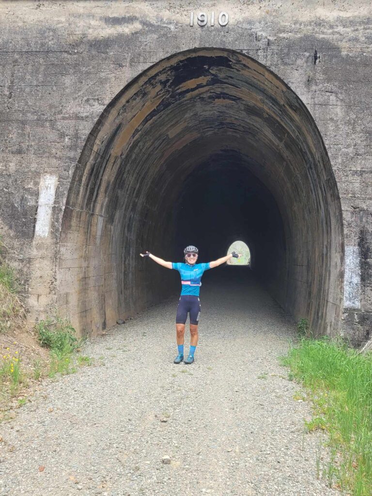
We stopped for the requisite photo at the Harlin tunnel – the only tunnel on the BVRT, then cruised through Harlin. Bummed neither of us were up for the legendary Harlin Hotel Schnitty, served with an appointment with your cardiologist for dessert.
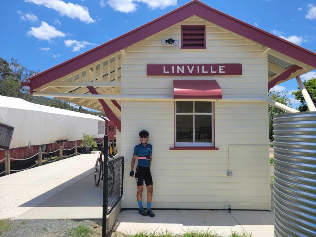
I love the section of the BVRT after this that goes north towards Moore, and a stop for a cold drink there. It’s then a quick 8km run on the trail from Moore to Linville, with a nice photo at the newly refurbished station there to finish with.
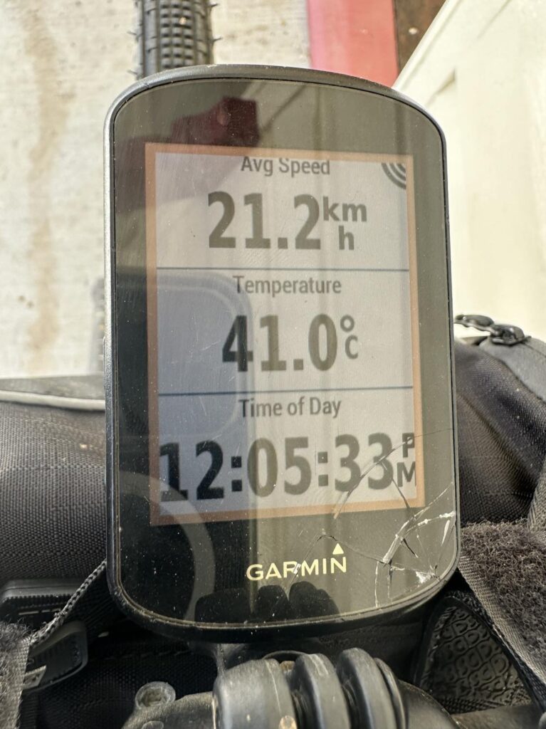
This route turned out to be spot on for time taking us 5 hours 16 minutes with an elapsed time of 6 and a half hours. Again it was ‘quite’ hot towards the end, see Garmin exhibit A.
Overall it was a super weekend as both a reccie for our trip, exploring new trails and connecting with others. There is a reason gravel riding is growing so fast. It’s a lovely combination of endurance, scenery, banter, bakeries and challenge.

Links
- Cervelo – https://www.cervelo.com/en-AU/bikes/aspero-5
- Aeroe – https://aeroe.com/collections/all
- Scicon bags – https://sciconsports.com/au_en/handlebar-bag-black-bg047010506
- Rail Trail refuge – https://railtrailrefuge.com.au/
- Day 1 ride route – https://www.strava.com/activities/10350846834
- Youtube Day 1 – https://www.youtube.com/watch?v=eplhIUdKGiM
- Day 2 ride route – https://www.strava.com/activities/10355898619
- Youtube Day 2 – https://www.youtube.com/watch?v=AXRpS9n503s&t=25s
- Youtube Rail Trail refuge – https://www.youtube.com/watch?v=mV1NA0zs3Cw